
Warning Signs
1.1 Railway Crossing with Barrier
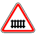
Warns of an approach to a railway crossing with a barrier.
1.2 Railway Crossing without Barrier
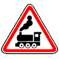
Warns of an approach to a railway crossing without a barrier.
1.3.1 Single-Track Railway

Warns of an approach to a single-track railway crossing without a barrier.
1.3.2 Multi-Track Railway

Warns of an approach to a railway crossing without a barrier that has two or more tracks.
1.4.1 Approaching Railway Crossing

Gives the driver an additional warning of an approach to a railway crossing outside a built-up area.
1.4.2 Approaching Railway Crossing
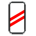
Gives the driver an additional warning of an approach to a railway crossing outside a built-up area.
1.4.3 Approaching Railway Crossing
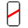
Gives the driver an additional warning of an approach to a railway crossing outside a built-up area.
1.4.4 Approaching a Railway Crossing

Gives the driver an additional warning of an approach to a railway crossing outside a built-up area.
1.4.5 Approaching a Railway Crossing

Gives the driver an additional warning of an approach to a railway crossing outside a built-up area.
1.4.6 Approaching a Railway Crossing

Gives the driver an additional warning of an approach to a railway crossing outside a built-up area.
1.5 Tram Line Crossing
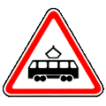
Warns of a tramway crossing the road.
1.6 Intersection of Roads of Equal Importance
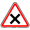
A junction where roads of equal importance cross.
1.7.1 Intersection with Secondary Road (Both Sides)
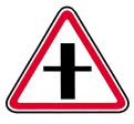
(Joining from the right — 1.7.2, 1.7.4 and 1.7.6; joining from the left — 1.7.3, 1.7.5 and 1.7.7.) A crossing with, or a junction of, a road whose drivers must give way. Signs 1.7.1−1.7.7 stand before the hazard: 150−300 metres ahead outside a built-up area, 50–100 metres ahead within one.
1.7.2 Intersection with Secondary Road (Right)
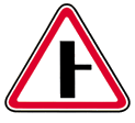
(Joining from the right — 1.7.2, 1.7.4 and 1.7.6; joining from the left — 1.7.3, 1.7.5 and 1.7.7.) A crossing with, or a junction of, a road whose drivers must give way. Signs 1.7.1−1.7.7 stand before the hazard: 150−300 metres ahead outside a built-up area, 50–100 metres ahead within one.
1.7.3 Intersection with Secondary Road (Left)
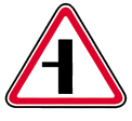
(Joining from the right — 1.7.2, 1.7.4 and 1.7.6; joining from the left — 1.7.3, 1.7.5 and 1.7.7.) A crossing with, or a junction of, a road whose drivers must give way. Signs 1.7.1−1.7.7 stand before the hazard: 150−300 metres ahead outside a built-up area, 50–100 metres ahead within one.
1.7.4 Side Road Junction
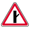
(Joining from the right — 1.7.2, 1.7.4 and 1.7.6; joining from the left — 1.7.3, 1.7.5 and 1.7.7.) A crossing with, or a junction of, a road whose drivers must give way. Signs 1.7.1−1.7.7 stand before the hazard: 150−300 metres ahead outside a built-up area, 50–100 metres ahead within one.
1.7.5 Side Road Junction
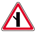
(Joining from the right — 1.7.2, 1.7.4 and 1.7.6; joining from the left — 1.7.3, 1.7.5 and 1.7.7.) A crossing with, or a junction of, a road whose drivers must give way. Signs 1.7.1−1.7.7 stand before the hazard: 150−300 metres ahead outside a built-up area, 50–100 metres ahead within one.
1.7.6 Side Road Junction
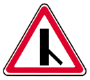
(Joining from the right — 1.7.2, 1.7.4 and 1.7.6; joining from the left — 1.7.3, 1.7.5 and 1.7.7.) A crossing with, or a junction of, a road whose drivers must give way. Signs 1.7.1−1.7.7 stand before the hazard: 150−300 metres ahead outside a built-up area, 50–100 metres ahead within one.
1.7.7 Side Road Junction
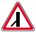
(Joining from the right — 1.7.2, 1.7.4 and 1.7.6; joining from the left — 1.7.3, 1.7.5 and 1.7.7.) A crossing with, or a junction of, a road whose drivers must give way. Signs 1.7.1−1.7.7 stand before the hazard: 150−300 metres ahead outside a built-up area, 50–100 metres ahead within one.
1.8 Roundabout Intersection
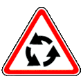
Warns of an approach to a roundabout marked by sign 4.3.
1.9 Traffic Light Regulation
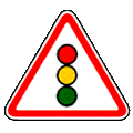
A junction, pedestrian crossing or stretch of road — other than a railway crossing — where traffic is controlled by a signal.
1.10 Drawbridge
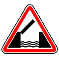
Warns of an approach to a swing bridge or a ferry crossing.
1.11 Exit to Embankment
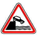
A road running out onto an embankment or the shore of a body of water.
1.12.1 Dangerous Curve
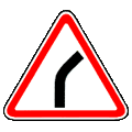
A dangerous bend of small radius or with restricted visibility: 1.12.1 to the right, 1.12.2 to the left.
1.12.2 Dangerous Bend to the Left
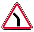
A dangerous bend of small radius or with restricted visibility: 1.12.1 to the right, 1.12.2 to the left.
1.13.1 Dangerous Curves
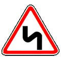
A stretch of road with dangerous bends: 1.13.1 with the first bend to the right, 1.13.2 with the first bend to the left.
1.13.2 Dangerous Curves
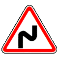
A stretch of road with dangerous bends: 1.13.1 with the first bend to the right, 1.13.2 with the first bend to the left.
1.14 Steep Descent
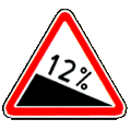
Warns of an approach to a stretch of road with a steep descent.
1.15 Steep Ascent
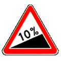
Warns of an approach to a stretch of road with a steep climb.
1.16 Slippery Road
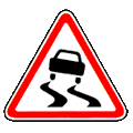
A slippery stretch of road where the tyre's grip coefficient on the surface is below 0.4.
1.17 Uneven Road
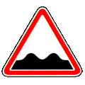
A stretch of road whose carriageway is damaged — waves, potholes, an uneven joint with a bridge and the like.
1.18 Road Hump
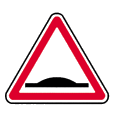
A stretch of road with an artificial hump built to force traffic to slow down.
1.19 Loose Gravel
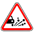
A stretch of road where chippings, gravel and the like may be thrown up from under vehicle wheels.
1.20 Soft Verge
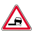
A stretch of road whose verge does not meet the applicable standards.
1.21.1 Road Narrows (Both Sides)
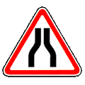
A stretch of road where the carriageway narrows: 1.21.1 from both sides, 1.21.2 from the right, 1.21.3 from the left.
1.21.2 Road Narrows (Right Side)
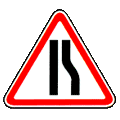
A stretch of road where the carriageway narrows: 1.21.1 from both sides, 1.21.2 from the right, 1.21.3 from the left.
1.21.3 Road Narrows (Left Side)
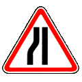
A stretch of road where the carriageway narrows: 1.21.1 from both sides, 1.21.2 from the right, 1.21.3 from the left.
1.22 Two-Way Traffic
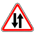
The start of a two-way stretch of road or carriageway that follows a one-way stretch.
1.23 Pedestrian Crossing
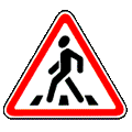
Warns of an approach to a pedestrian crossing marked by signs 5.19.1 and 5.19.2 and/or by markings 1.14.1–1.14.2.
1.24 Children
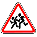
Warns that a children's institution stands beside this stretch of road, so children are likely to appear on the carriageway.
1.25 Bicycle Path Crossing
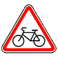
Warns of an approach to a place where a cycle track marked by sign 4.4 crosses the carriageway.
1.26 Road Works
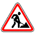
A stretch of road where work is under way.
1.27 Cattle Crossing
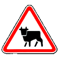
A stretch of road running past a livestock pen, a farm and/or a regular cattle crossing, where animals may appear on the carriageway.
1.28 Wild Animals
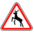
A stretch of road running past a nature reserve, a hunting ground or woodland, or another place where wild animals may appear.
1.29 Falling Rocks
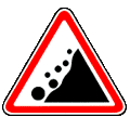
A stretch of road whose carriageway is not protected from avalanches, landslides or falling rocks.
1.30 Side Wind
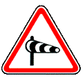
A stretch of road where a strong crosswind may blow.
1.31 Low-Flying Aircraft
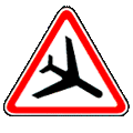
A stretch of road near an aerodrome over which aeroplanes or helicopters fly at low altitude.
1.32 Tunnel
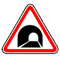
Warns of an approach to a road tunnel — the stretch before the tunnel and/or before the road that bypasses it.
1.33 Traffic Queue
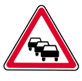
A stretch of road temporarily blocked by a queue of traffic.
1.34 Other Dangers

A stretch of road where a hazard may arise that no other warning sign covers.
1.35.1 Chevron — Direction of the Bend
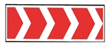
Shows the direction of travel round a small-radius bend with restricted visibility (1.35.1−1.35.3 to the right, 1.35.4−1.35.6 to the left), or the corresponding way round a road works site.
1.35.2 Chevron — Direction of the Bend

Shows the direction of travel round a small-radius bend with restricted visibility (1.35.1−1.35.3 to the right, 1.35.4−1.35.6 to the left), or the corresponding way round a road works site.
1.35.3 Chevron — Direction of the Bend

Shows the direction of travel round a small-radius bend with restricted visibility (1.35.1−1.35.3 to the right, 1.35.4−1.35.6 to the left), or the corresponding way round a road works site.
1.35.4 Chevron — Direction of the Bend
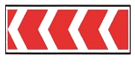
Shows the direction of travel round a small-radius bend with restricted visibility (1.35.1−1.35.3 to the right, 1.35.4−1.35.6 to the left), or the corresponding way round a road works site.
1.35.5 Chevron — Direction of the Bend

Shows the direction of travel round a small-radius bend with restricted visibility (1.35.1−1.35.3 to the right, 1.35.4−1.35.6 to the left), or the corresponding way round a road works site.
1.35.6 Chevron — Direction of the Bend

Shows the direction of travel round a small-radius bend with restricted visibility (1.35.1−1.35.3 to the right, 1.35.4−1.35.6 to the left), or the corresponding way round a road works site.
1.36.1 Chevron — Direction at a T-Junction
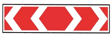
Shows the directions available — right and left — at a T-junction or a fork, or the way round a road works site.
1.36.2 Chevron — Direction at a T-Junction
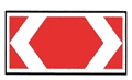
Shows the directions available — right and left — at a T-junction or a fork, or the way round a road works site.
Note: (a) signs 1.1, 1.2 and 1.5–1.34 stand 150–300 m before the hazard outside a built-up area and 50–100 m before it within one; where necessary they may stand at another distance, which is then shown on plate 8.1.1; (b) signs 1.1, 1.2, 1.10, 1.11, 1.23, 1.24 and 1.26 are repeated outside built-up areas, and signs 1.24 and 1.26 within them as well, the second sign standing at least 50 m before the hazard begins; (c) where a climb and a descent (or a descent and a climb) follow one another, signs 1.14 and 1.15 may stand immediately before the climb and the descent respectively, without plate 8.1.1; (d) for short-lived work on the carriageway, sign 1.26 stands 10–15 m from the works and without plate 8.1.1; (e) signs 1.3.1 and 1.3.2 stand immediately before the railway crossing; (f) signs 1.4.1–1.4.3 stand on the right-hand side of the road and signs 1.4.4–1.4.6 on the left. Signs 1.4.1 and 1.4.4 go with the first and the repeated 1.1 or 1.2 in the direction of travel, signs 1.4.3 and 1.4.6 with the duplicated 1.1 or 1.2, and signs 1.4.2 and 1.4.5 stand on their own, midway between the first and the repeated 1.1 or 1.2.
Priority Signs
2.1 Main Road
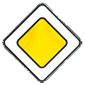
A road whose drivers have priority at an uncontrolled junction. The sign stands at the start of the road and is repeated immediately before every junction. With plate 8.13 it stands, within a built-up area, before the junction where the major road changes direction, and outside one both 150−300 metres in advance and at the junction itself.
2.2 End of Main Road
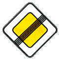
The end of the stretch from which the road ceases to be the major road. Where the major road ends before a crossing with a road that has priority at that junction, sign 2.2 stands in advance together with sign 2.4 outside a built-up area, and 25 metres from the junction and/or together with sign 2.3 or 2.4 within one. It may also stand at another distance, shown on plate 8.1.1.
2.3 Yield (Give Way)
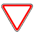
A road whose drivers must give way to traffic on the road being crossed, or — where plate 8.13 is present — to traffic on the major road. Outside a built-up area sign 2.3 stands 150−300 metres in advance, with plate 8.1.1 if a 2.3 stands at the junction, or with plate 8.1.2 if a 2.4 does.
2.4 No Entry Without Stopping

Forbids the driver to go on without stopping at the stop line, or where there is none, at the edge of the carriageway being crossed. The driver must give way to traffic on the road being crossed, or — where plate 8.13 is present — to traffic on the major road. The sign is used where traffic on the crossing road cannot be seen. It may also stand before a railway crossing or a quarantine post, in which case the driver must stop at the stop line, or at the sign if there is none.
2.5 Priority of Oncoming Traffic
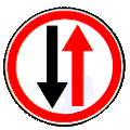
Forbids the driver to enter a narrow stretch where doing so would obstruct oncoming traffic. The driver must give way to an oncoming vehicle already at the opposite approach or on the narrow stretch.
2.6 Priority over Oncoming Traffic
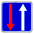
Gives the driver priority over a vehicle coming the other way when passing a narrow stretch of road.
Note: (a) signs 2.3 and 2.4 apply to the intersection of carriageways the sign stands before; (b) signs 2.5 and 2.6 stand immediately before the narrow section. Sign 2.5 may be placed in advance together with plate 8.1.1.
Prohibitory Signs
3.1 No Entry
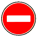
Prohibits the entry of all vehicles in the given direction.
3.2 No Vehicles

Prohibits the movement of all vehicles in both directions. It does not apply to route service vehicles; to vehicles serving businesses inside the marked zone or belonging to people living or working there (entering and leaving at the junction nearest the destination); or to vehicles driven by, or carrying, a person with a significant or pronounced disability status.
3.3 No Motor Vehicles
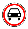
Prohibits the movement of all types of motor vehicle. It does not apply to route service vehicles, to vehicles serving the marked zone, or to vehicles of people with a significant or pronounced disability status.
3.4 No Goods Vehicles
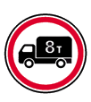
Prohibits vehicles and vehicle combinations whose permitted maximum mass exceeds the figure shown on the sign. It does not apply to vehicles serving businesses inside the marked zone or belonging to people living or working there.
3.5 No Motorcycles
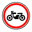
Prohibits the movement of motorcycles of all types. It does not apply to vehicles serving businesses inside the marked zone or belonging to people living or working there.
3.6 No Tractors
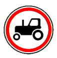
Prohibits the movement of tractors of all types and of specialised self-propelled machinery. It does not apply to vehicles serving businesses inside the marked zone or belonging to people living or working there.
3.7 No Vehicles with Trailer
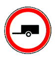
Prohibits goods vehicles and tractors towing a trailer of any type, and also the towing of motor vehicles.
3.8 No Animal-Drawn Vehicles
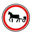
Prohibits animal-drawn vehicles, pack and riding animals, and the driving of livestock.
3.9 No Cycles
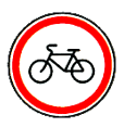
Prohibits the movement of bicycles and mopeds.
3.10 No Pedestrians
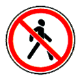
Prohibits pedestrian movement. The sign is placed where walking is unsafe, and it applies only to the side of the road on which it stands.
3.11 Mass Limit
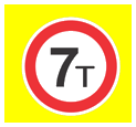
Prohibits vehicles and vehicle combinations whose total actual mass exceeds the figure shown on the sign.
3.12 Axle Load Limit
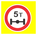
Prohibits vehicles whose actual load on any one axle exceeds the figure shown on the sign.
3.13 Height Limit
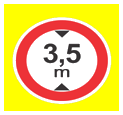
Prohibits vehicles whose overall height, laden or unladen, exceeds the figure shown on the sign.
3.14 Width Limit
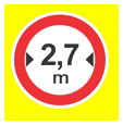
Prohibits vehicles whose overall width, laden or unladen, exceeds the figure shown on the sign.
3.15 Length Limit
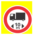
Prohibits vehicles and vehicle combinations whose overall length, laden or unladen, exceeds the figure shown on the sign.
3.16 Minimum Distance
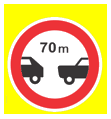
Prohibits vehicles from following each other at less than the distance shown on the sign. It applies up to the next junction, or in a built-up area with no junction up to the end of the built-up area; plate 8.2.1 can shorten that zone.
3.17.1 Customs
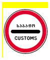
Prohibits passing a customs checkpoint — the customs control zone at the Georgian customs border — without stopping.
3.17.2 Danger
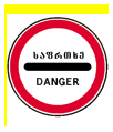
Prohibits any vehicle from proceeding further because of a road traffic accident or other hazard.
3.17.3 Control
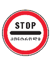
Prohibits passing a control point without stopping — a police or quarantine post, an entrance to a border or restricted zone, an exit onto a toll road, and so on.
3.18.1 No Right Turn
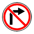
Prohibits turning right at the nearest intersection of carriageways — the one the sign stands before. It does not apply to route service vehicles.
3.18.2 No Left Turn
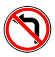
Prohibits turning left at the nearest intersection of carriageways — the one the sign stands before. It does not apply to route service vehicles.
3.19 No U-Turn
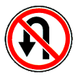
Prohibits a U-turn at the nearest intersection of carriageways. It does not apply to route service vehicles.
3.20 No Overtaking
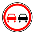
Prohibits overtaking any motor vehicle other than one travelling below 30 km/h. Overtaking a solo motorcycle, a moped or a bicycle is allowed provided you do not move onto the oncoming lane. The restriction runs to the next junction, or in a built-up area with no junction to the end of the built-up area; it also ends at sign 3.21 or can be shortened by plate 8.2.1.
3.21 End of No Overtaking
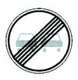
Marks the end of the zone of sign 3.20 'No Overtaking'.
3.22 No Overtaking by Goods Vehicles
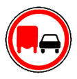
Prohibits goods vehicles with a permitted maximum mass above 3.5 t from overtaking any vehicle other than one travelling below 30 km/h, and prohibits tractors from overtaking anything other than an animal-drawn vehicle or a bicycle.
3.23 End of No Overtaking by Goods Vehicles
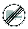
Marks the end of the zone of sign 3.22 'No Overtaking by Goods Vehicles'.
3.24 Maximum Speed Limit
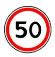
Prohibits travelling faster than the speed in km/h shown on the sign. It applies to the next junction, or in a built-up area with no junction to the end of the built-up area; it also ends at sign 3.25, at another 3.24 showing a different speed, or where plate 8.2.1 shortens it. A 3.24 placed before a built-up area marked by 5.23.1 or 5.23.2 applies as far as that sign.
3.25 End of Maximum Speed Limit
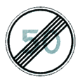
Marks the end of the zone of sign 3.24 'Maximum Speed Limit'.
3.26 No Sounding of Horn
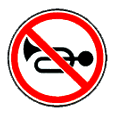
Prohibits use of the horn except where it is sounded to prevent a road traffic accident. Plate 8.2.1 can shorten the zone.
3.27 No Stopping

Prohibits both stopping and parking. It applies only to the side of the road on which it stands and runs to the next junction. It does not apply to route service vehicles. It may be used together with marking 1.4, in which case the length of the marked line defines the zone.
3.28 No Parking

Prohibits parking. It applies only to the side of the road on which it stands. It does not apply to postal vehicles bearing a white diagonal stripe on a blue panel, to taxis with the meter running, or to vehicles of people with a significant or pronounced disability status. It may be used together with marking 1.10.
3.29 No Parking on Odd-Numbered Days
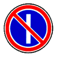
Prohibits parking on odd-numbered days of the month. It applies only to the side of the road on which it stands.
3.30 No Parking on Even-Numbered Days

Prohibits parking on even-numbered days of the month. Where 3.29 and 3.30 are used together, vehicles are moved from one side of the road to the other between 19:00 and 21:00, and during that period parking is allowed on both sides of the carriageway.
3.31 End of All Restrictions

Marks the end of the zones of several of signs 3.16, 3.20, 3.22, 3.24 and 3.26–3.30 at once.
3.32 No Vehicles Carrying Dangerous Goods
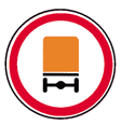
Prohibits vehicles carrying dangerous goods that Georgian law requires to display the corresponding identification sign. It is used to keep such vehicles on their designated route and to bar them from roads or districts where they would pose a particular danger to people.
3.33 No Vehicles Carrying Explosives or Flammable Goods
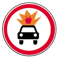
Prohibits vehicles carrying explosive or flammable goods of classes 1.22–2.4, 3.1, 3.2 and 5.2 under state standard 19433-88 which Georgian law requires to display the 'Dangerous Goods' identification sign.
3.34 No Stopping at a Fire Hydrant
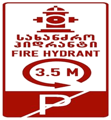
Prohibits both stopping and parking at a fire hydrant. The sign is placed at the hydrant and applies within a radius of 3.5 metres of it; for an underground hydrant the cover counts as part of the zone. It may be used together with the red marking 1.28, in which case the marked line defines the zone — but the absence of marking 1.28 does not release the driver from the sign's requirement. It does not apply to fire engines.
Note: Where signs 3.29 and 3.30 are used together, vehicles are moved from one side of the road to the other between 19:00 and 21:00. During that period parking is allowed on both sides of the carriageway.
Note: (a) signs 3.32 and 3.33 are used to keep vehicles carrying dangerous, explosive and flammable goods on their designated route and to bar them from roads or districts where they would pose a particular danger to people; (b) signs 3.2–3.9, 3.32 and 3.33 bar the corresponding type of vehicle and mean that movement is prohibited in both directions; (c) the signs do not apply: (c.a) signs 3.1–3.3, 3.18.1, 3.18.2, 3.19 and 3.27 — to route service vehicles; (c.b) signs 3.2–3.8 — to vehicles serving businesses inside the marked zone or belonging to people living or working there, which enter and leave the zone at the junction nearest their destination; (c.c) signs 3.28–3.30 — to postal vehicles bearing a white diagonal stripe on a blue panel and to taxis with the meter running; (c.d) signs 3.2, 3.3 and 3.28–3.30 — to vehicles driven by, or carrying, a person with a significant or pronounced disability status; (c.e) sign 3.34 — to fire engines; (d) signs 3.18.1 and 3.18.2 apply to the intersection of carriageways the sign stands before; (e) signs 3.16, 3.20, 3.22, 3.24 and 3.26–3.30 apply from where they stand to the next junction, or in a built-up area with no junction to the end of the built-up area; they also apply across exits from adjoining areas and across crossings or junctions with field, forest and other secondary roads that carry no sign of their own; (f) a 3.24 placed before a built-up area marked by 5.23.1 or 5.23.2 applies as far as that sign; (g) the zone is shortened: (g.a) for signs 3.16 and 3.26 — by plate 8.2.1; (g.b) for signs 3.20, 3.22 and 3.24 — by placing 3.21, 3.23 and 3.25 respectively at the end of the zone, or by plate 8.2.1; (g.c) for sign 3.24 — by another 3.24 showing a different speed; (g.d) for signs 3.27–3.30 — by repeating 3.27–3.30 with plate 8.2.3 at the end of the zone, or by plate 8.2.2, or by sign 7.4 with plate 8.2.1; (h) sign 3.27 may be used with marking 1.4 and sign 3.28 with marking 1.10, the length of the marked line then defining the zone; (i) signs 3.10 and 3.27–3.30 apply only to the side of the road on which they stand; (j) sign 3.34 applies within a radius of 3.5 m, and for an underground hydrant the cover counts as part of the zone; it may be used with marking 1.28, and the marked line then defines the zone. Sign 3.34 stands at the hydrant.
Mandatory Signs
4.1.1 Straight Ahead Only

Obliges the driver to move only straight ahead. Applies to the intersection of carriageways before which the sign is installed. When installed at the start of a road, it applies up to the next intersection. The sign does not prohibit turning right into a courtyard or other adjacent territories. Does not apply to route service vehicles.
4.1.2 Right Turn Only

Obliges the driver to move only to the right. Applies to the intersection before which the sign is installed. Does not apply to route service vehicles.
4.1.3 Left Turn Only

Obliges the driver to move only to the left. The effect of the sign extends to the intersection of carriageways before which it is placed. It does not apply to route service vehicles.
4.1.4 Straight or Right

Obliges the driver to move only straight or to the right.
4.1.5 Straight or Left

Obliges the driver to move only straight, to the left, or in the reverse direction.
4.1.6 Right or Left

Obliges the driver to move only to the right, to the left, or in the reverse direction.
4.2.1 Pass Obstacle on the Right

Shows that a central reservation, refuge island or other obstruction is to be passed on the right only.
4.2.2 Pass Obstacle on the Left

Shows that a central reservation, refuge island or other obstruction is to be passed on the left only.
4.2.3 Pass Obstacle on Either Side

Shows that a central reservation, refuge island or other obstruction may be passed on either the right or the left.
4.3 Roundabout

Permits movement in the directions the arrows show at a junction laid out as a roundabout.
4.4 Bicycle Path

A track for cycling, structurally separated from the road or from the road's other elements. Sign 4.4 stands as the primary sign at the start of the cycle track and is repeated after every crossing with a road.
4.5 Pedestrian Path
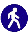
A path separated from the road and intended for pedestrians. Sign 4.5 stands as the primary sign at the start of the footpath and is repeated after every crossing with a road.
4.6 Minimum Speed Limit
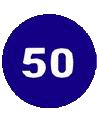
Sets the minimum speed for the road. It applies from where it stands to the next junction, or in a built-up area with no junction, to the end of the built-up area.
4.7 End of Minimum Speed Limit Zone
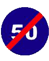
The end of the zone of sign 4.6.
4.8 Snow Chains Compulsory

A stretch of road on which a vehicle must run with snow chains fitted to at least two driving wheels.
4.9.1 Direction of Movement for Hazardous Goods Vehicles (Straight)
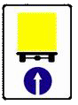
Shows the direction permitted to a vehicle carrying dangerous goods that Georgian law requires to display the 'Dangerous Goods' identification sign: 4.9.1 straight ahead, 4.9.2 to the right, 4.9.3 to the left.
4.9.2 Direction of Movement for Hazardous Goods Vehicles (Right)
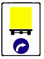
Shows the direction permitted to a vehicle carrying dangerous goods that Georgian law requires to display the 'Dangerous Goods' identification sign: 4.9.1 straight ahead, 4.9.2 to the right, 4.9.3 to the left.
4.9.3 Direction of Movement for Hazardous Goods Vehicles (Left)
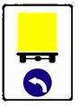
Shows the direction permitted to a vehicle carrying dangerous goods that Georgian law requires to display the 'Dangerous Goods' identification sign: 4.9.1 straight ahead, 4.9.2 to the right, 4.9.3 to the left.
Note: (a) signs 4.1.1−4.1.6 permit movement only in the directions the arrows show, and a sign that permits a left turn also permits a U-turn. Signs 4.1.1−4.1.6 may be used with the arrow configuration that suits the directions actually needed at that intersection; (b) signs 4.1.1−4.1.6 apply to the intersection of carriageways the sign stands before; (c) signs 4.1.1−4.1.6 do not apply to route service vehicles; (d) a 4.1.1 placed at the start of a stretch of road applies to the next junction, and it does not forbid turning right into a yard or another area adjoining the road.
Special Regulation Signs
5.1 Motorway
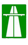
A motorway on which the rules governing motorway traffic apply. The sign stands at the start of the motorway or near it with plate 8.1.1.
5.2 End of Motorway
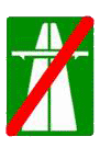
Marks the end of the road indicated by sign 5.1. It stands at the end of the motorway, at the exit from it, and in advance with plate 8.1.1 at 400 and 1000 metres before the end.
5.3 Expressway
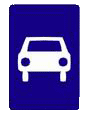
A road intended for cars and motorcycles only.
5.4 End of Expressway
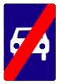
Marks the end of the road indicated by sign 5.3.
5.5 One-Way Road
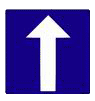
A road or carriageway on which vehicles travel in one direction across its whole width.
5.6 End of One-Way Road
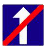
Marks the end of the road or carriageway indicated by sign 5.5.
5.7.1 Exit onto One-Way Road

Marks an entry onto a one-way road or carriageway. The signs stand before every side entrance; they may be omitted where an adjoining area can only be reached from the road marked by sign 5.5.
5.7.2 Exit onto One-Way Road

Marks an entry onto a one-way road or carriageway. The signs stand before every side entrance; they may be omitted where an adjoining area can only be reached from the road marked by sign 5.5.
5.8 Reversible Traffic
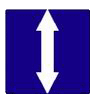
The start of a stretch of road where the direction of travel on one or more lanes can be reversed.
5.9 End of Reversible Traffic

Marks the end of the stretch indicated by sign 5.8.
5.10 Exit onto Reversible Traffic Road
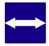
Marks an entry onto the stretch indicated by sign 5.8. It stands before every side exit; it may be omitted where an adjoining area can only be reached from the road marked by sign 5.8.
5.11 Road with Lane for Route Service Vehicles (Counter-Flow)
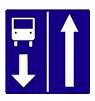
A road on which route service vehicles use a dedicated lane running against the general flow of traffic. The sign applies to the lane it stands over.
5.11.1 Road with a Taxi Lane (Category M1)
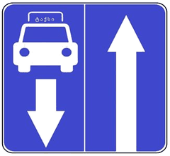
A road on which taxis (category M1) use a dedicated lane running against the general flow of traffic, and which is at the same time a road with a route-vehicle lane marked by sign 5.11. The effect of sign 5.11.1 extends to the traffic lane on which it stands. This sign does not oblige a taxi (category M1) to travel only in that lane.
5.12 End of Road with Lane for Route Service Vehicles
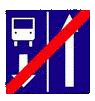
Marks the end of the road indicated by sign 5.11.
5.12.1 End of Road with a Taxi Lane (Category M1)
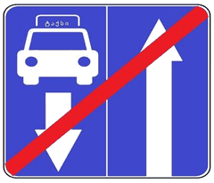
Marks the end of the road indicated by sign 5.11.1.
5.13.1 Exit onto Road with Counter-Flow Route Service Lane
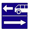
Marks an entry onto the road indicated by sign 5.11. The signs stand before every side entrance; they may be omitted where an adjoining area can only be reached from the road marked by sign 5.11.
5.13.2 Exit onto Road with Counter-Flow Route Service Lane
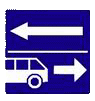
Marks an entry onto the road indicated by sign 5.11. The signs stand before every side entrance; they may be omitted where an adjoining area can only be reached from the road marked by sign 5.11.
5.13.3 Entering a Road with a Taxi Lane (Category M1)
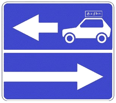
Marks an entry onto the road indicated by sign 5.11.1. Signs 5.13.3 and 5.13.4 stand before every side entrance; they may be omitted where an adjoining area can only be reached from the road marked by 5.11.1.
5.13.4 Entering a Road with a Taxi Lane (Category M1)
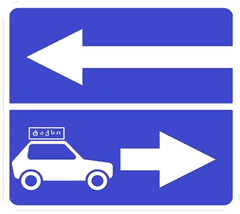
Marks an entry onto the road indicated by sign 5.11.1. Signs 5.13.3 and 5.13.4 stand before every side entrance; they may be omitted where an adjoining area can only be reached from the road marked by sign 5.11.1.
5.14 Lane for Route Service Vehicles
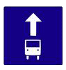
A road on which route service vehicles use a dedicated lane running with the general flow of traffic. The sign applies to the lane it stands over; placed at the right-hand side of the road it applies to the rightmost lane of the carriageway.
5.14.1 Taxi Lane (Category M1)
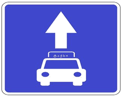
A lane on which taxis (category M1) travel in the same direction as the general flow of traffic and which is at the same time the route-vehicle lane marked by sign 5.14. The sign applies to the lane it is placed above. This sign does not oblige a taxi (category M1) to travel only in that lane. Where the sign is placed on the right-hand side of the road, its effect extends to the rightmost lane of the carriageway.
5.15.1 Lane Direction Indicators
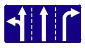
Shows the number of lanes and the directions permitted from each.
5.15.2 Direction in Lane
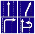
Shows the directions permitted from the lane.
5.15.3 Beginning of Lane
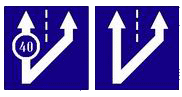
Marks the start of a deceleration or additional lane on a climb, at a fork or at a crossing. Where the 5.15.3 placed before an additional lane carries sign 4.6 ('Minimum Speed Limit'), a driver who cannot keep to that speed or better in the main lane must move into the additional lane.
5.15.4 Beginning of Lane
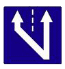
Marks the start of the section of the middle lane of a three-lane road that is given over to traffic in this direction.
5.15.5 End of Lane
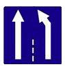
Marks the end of a deceleration or additional lane on a climb.
5.15.6 End of Lane
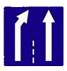
Marks the end of the section of a lane of a three-lane road that is given over to traffic in this direction.
5.15.7 Lane Directions
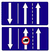
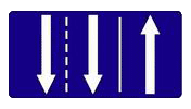
Shows the number of lanes and the direction of travel on each. Where the 5.15.7 carries another sign barring some class of vehicle, that class may not use the corresponding lane.
5.15.8 Number of Lanes
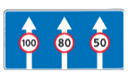
Shows how many lanes run in the given direction and the rules that apply to each. It stands 150–300 m before the section outside a built-up area, or 50–150 m before it within one.
5.16 Bus or Trolleybus Stop
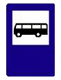
Indicates the stop of a bus or trolleybus on a fixed route. In built-up areas, the driver must give way to buses and trolleybuses starting from a marked stop. Bus and trolleybus drivers begin moving only when they are sure they are being given way. Stopping a vehicle within 15 meters of a marked route service vehicle stop (or, if absent, of the stop indicator) is prohibited if it obstructs route service vehicles.
5.17 Tram Stop
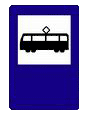
Indicates a marked tram stop. The driver must give way to pedestrians heading toward or coming from a tram stopped at a marked stop in the middle of the carriageway, in the same direction.
5.18 Taxi Stop
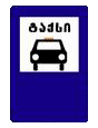
Indicates a marked taxi stop. Stopping within 15 meters of the marked taxi stop area (or, if absent, of the indicator) is prohibited if it obstructs taxis.
5.19.1 Pedestrian Crossing
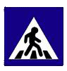
The place on the road set aside for pedestrians to cross. Sign 5.19.1 stands on the right-hand side of the road and sign 5.19.2 on the left. Where the crossing carries no 1.14 marking, 5.19.1 stands at the near edge of the crossing and 5.19.2 at the far edge.
5.19.2 Pedestrian Crossing
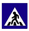
The place on the road set aside for pedestrians to cross. Sign 5.19.1 stands on the right-hand side of the road and sign 5.19.2 on the left. Where the crossing carries no 1.14 marking, 5.19.1 stands at the near edge of the crossing and 5.19.2 at the far edge.
5.20 Road Hump
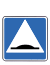
Indicates a road hump on the carriageway. It faces approaching traffic and stands at the hump itself or at marking 1.25.
5.21 Residential Zone
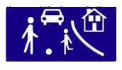
An area where the rules for a residential zone apply. The sign stands at every entrance to the zone.
5.22 End of Residential Zone
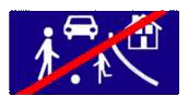
Marks the end of the residential zone indicated by sign 5.21. The sign stands at every exit from the zone.
5.23.1 Beginning of Built-up Area
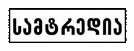
Marks the start of a built-up area in which the rules for built-up areas apply.
5.23.2 Beginning of a Built-Up Area
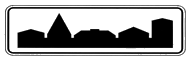
Marks the start of a built-up stretch of road that is not part of any settlement but where the rules for built-up areas apply — holiday villages, isolated institutions and the like.
5.24.1 End of Built-up Area

Marks the end of the built-up area indicated by sign 5.23.1.
5.24.2 End of a Built-Up Area
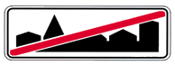
Marks the end of the built-up area indicated by sign 5.23.2.
5.25 Beginning of Built-up Area (No Built-up Rules)

Marks the start of a built-up area in which the rules for built-up areas do not apply.
5.26 End of Built-up Area

Marks the end of the built-up area indicated by sign 5.25.
5.27 Restricted Parking Zone
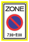
Marks the start of an area within which parking is restricted. The restriction and the hours it applies are shown on the sign itself.
5.28 End of Restricted Parking Zone
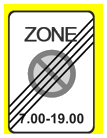
Marks the end of the zone indicated by sign 5.27.
5.29 Controlled Parking Zone
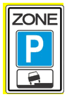
Marks the start of an area where parking is allowed only in places set out by signs and markings.
5.30 End of Controlled Parking Zone
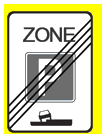
Marks the end of the zone indicated by sign 5.29.
5.31 Maximum Speed Limit Zone
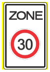
Marks the start of an area within which travelling faster than the speed shown on the sign is prohibited.
5.32 End of Maximum Speed Limit Zone
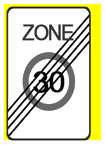
Marks the end of the zone indicated by sign 5.31.
5.33 Pedestrian Zone
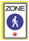
An area where only pedestrians may move.
5.34 End of Pedestrian Zone
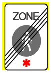
Marks the end of the area indicated by sign 5.33.
5.35 Hospital
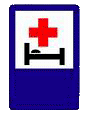
Indicates a medical facility near the road. Passing the sign, the driver should avoid unnecessary noise as far as possible.
5.36 Merging Point
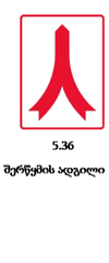
The point where a slip road's acceleration lane merges with the motorway.
5.37 Tunnel
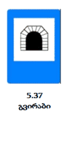
Marks the start of a road tunnel, from which the special rules for tunnels apply. It stands at or near the tunnel entrance, with or without plate 8.2.1; the length of the tunnel is shown at the foot of the sign or on plate 8.2.1.
5.38 End of Tunnel
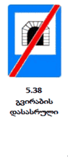
Marks the end of a road tunnel — the end of the stretch on which the special tunnel rules apply. It stands at the end of that stretch.
5.39 Zone Closed to Certain Vehicle Categories
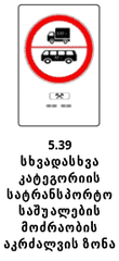
Marks an area within which vehicles of categories M3, N2, N3 and T — with the mass stated — are barred at the times and on the days shown on the sign.
5.40 End of Zone Closed to Certain Vehicle Categories
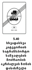
Marks the end of the area indicated by sign 5.39.
5.41 Lane for Motorcycles and Mopeds (Other than Three-Wheeled)
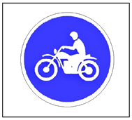
A route-vehicle lane on which motorcycles and mopeds — other than three-wheeled ones — are also allowed to travel.
5.41.1 Lane for Taxis (Category M1), Motorcycles and Mopeds (Other than Three-Wheeled)
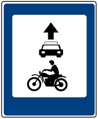
A lane on which taxis (category M1), motorcycles and mopeds — other than three-wheeled ones — travel in the same direction as the general flow of traffic, and which is at the same time the route-vehicle lane marked by sign 5.14. The effect of sign 5.41.1 extends to the traffic lane on which it stands. Sign 5.41.1 does not oblige a taxi (category M1), a motorcycle (other than three-wheeled) or a moped (other than three-wheeled) to travel only in that lane. Movement of a motorcycle (other than three-wheeled) and a moped (other than three-wheeled) is prohibited during the specified time and on the specified day(s), where such are indicated.
Note: (a) signs 5.15.1 and 5.15.2 that permit a turn from the leftmost lane also permit a U-turn from it; (b) signs 5.15.1 and 5.15.2 placed before a junction apply to the whole junction, unless other 5.15.1 or 5.15.2 signs there say otherwise; (c) signs 5.15.1 and 5.15.2 do not apply to route service vehicles.
Note: Signs 5.16−5.18 mark the stopping place of the corresponding route service vehicle and the taxi rank.
Note: Signs 5.23.1, 5.23.2 and 5.25 stand at every entrance to a built-up area, and signs 5.24.1, 5.24.2 and 5.26 at every exit, on the actual edge of the built-up land.
Note: (a) signs 5.27, 5.29 and 5.31 mark an area within which parking is regulated or the maximum speed is limited, as the case may be; (b) signs 5.28, 5.30 and 5.32 mark the end of the area indicated by 5.27, 5.29 and 5.31 respectively.
Note: Signs 5.27, 5.29, 5.31 and 5.33 stand at every entrance to the area, and signs 5.28, 5.30, 5.32 and 5.34 at every exit.
Note: Sign 5.39 does not apply to the exceptions Georgian law allows.
Object and Service Signs
6.1 First Aid Station
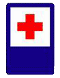
Indicates a facility where first medical aid can be obtained.
6.2 Filling Station
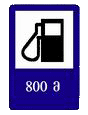
Indicates a facility where vehicles can be supplied with fuel and lubricants.
6.3 Vehicle Technical Service
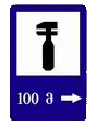
Indicates a facility where a vehicle can receive technical service.
6.4 Car Wash
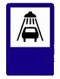
Indicates a facility where a vehicle can be washed.
6.5 Telephone

Indicates the location of a public telephone or communications service.
6.6 Food Service
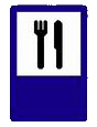
Indicates the location of a food service facility.
6.7 Drinking Water
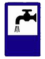
Indicates the location of drinking water.
6.8 Hotel or Motel
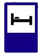
Indicates the location of a hotel or motel.
6.9 Camping
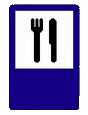
Indicates the location of a tourist resting facility.
6.10 Rest Area
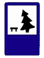
Indicates the location of a rest area near the road.
6.11 Traffic Police Post
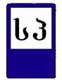
Indicates the location of a stationary traffic police post.
6.12 Police
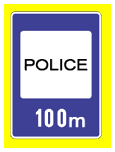
Indicates a police station.
6.13 International Road Haulage Checkpoint
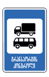
Indicates a checkpoint for international road haulage.
6.14 Radio Traffic Information Zone
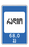
Marks the area where a radio station broadcasting traffic information can be received. The frequency is shown on the sign.
6.15 Emergency Radio Contact Zone
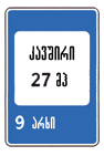
Marks the area within which radio contact with the emergency service can be established. The channel number is shown on the sign.
6.16 Swimming Pool or Beach
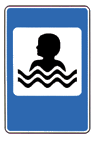
Indicates a swimming pool or a beach.
6.17 Toilet
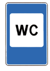
Indicates a toilet.
Information Signs
7.1 General Speed Limits
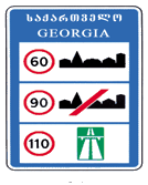
Sets out the general speed limits laid down by the traffic rules for roads in Georgia. The sign stands at the entry to Georgia, at the border checkpoint.
7.2 Recommended Speed
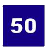
Shows the speed recommended for this stretch of road. The sign stands at the start of the stretch and applies to the next junction; used with a warning sign it applies for the whole length of the hazard.
7.3.1 U-Turn Place
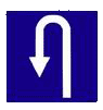
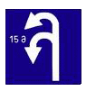
Marks a place to turn round. Sign 7.3.1 stands before or above that place, or in advance with plate 8.1.1. It does not permit a left turn.
7.4 Parking Place

A place set aside for parking. Road markings define the zone; where there are none the sign applies to the next junction, or plate 8.2.1 limits it.
7.5 Emergency Escape Lane
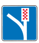
Indicates an emergency escape lane on a steep descent. The sign stands before the entrance to the lane.
7.6 Pedestrian Underground Crossing
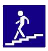
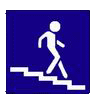
An underground pedestrian crossing.
7.7 Pedestrian Above-Ground Crossing
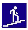
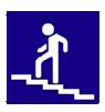
An overhead pedestrian crossing.
7.8.1 Dead End (Straight)

A road with no through route. Sign 7.8.1 stands at the start of the road; signs 7.8.2 and 7.8.3 stand before the crossing with the road that has no through route.
7.8.2 Dead End (Right)

A road with no through route. Sign 7.8.1 stands at the start of the road; signs 7.8.2 and 7.8.3 stand before the crossing with the road that has no through route.
7.8.3 Dead End (Left)

A road with no through route. Sign 7.8.1 stands at the start of the road; signs 7.8.2 and 7.8.3 stand before the crossing with the road that has no through route.
7.9.1 Advance Direction Indicator
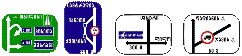
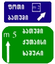
Signs 7.9.1 and 7.9.2 show the directions to a built-up area and to other destinations, and the way round a stretch of road where restrictions are in force. They also carry the image of sign 7.14.1, motorway and airport symbols, and sporting or other pictograms. Sign 7.9.1 additionally carries images of other signs that convey how traffic is arranged. The foot of a 7.9.1 states the distance from where it stands to the junction or to the start of the deceleration lane.
7.9.2 Advance Direction Indicator
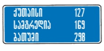
Signs 7.9.1 and 7.9.2 show the directions to a built-up area and to other destinations, and the way round a stretch of road where restrictions are in force. They also carry the image of sign 7.14.1, motorway and airport symbols, and sporting or other pictograms. Sign 7.9.1 additionally carries images of other signs that convey how traffic is arranged. The foot of a 7.9.1 states the distance from where it stands to the junction or to the start of the deceleration lane.
7.9.3 Movement Scheme
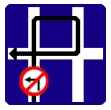
Shows how traffic moves through a junction where particular manoeuvres are barred, or the directions permitted at a complex junction. The sign stands immediately before the junction.
7.10.1 Direction Indicators
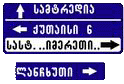
Shows the directions to a built-up area and to other destinations. The signs state the distance in kilometres to the places named, and carry motorway and airport symbols and sporting or other pictograms.
7.10.2 Direction Indicator
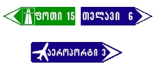
Shows the directions to a built-up area and to other destinations. The signs state the distance in kilometres to the places named, and carry motorway and airport symbols and sporting or other pictograms.
7.11 Object Name

Names something other than a settlement — a street, river, lake, pass, landmark and the like. The sign stands immediately before it.
7.12 Distance Indicator
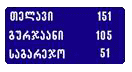
States the distance in kilometres to a built-up area or other destination along the route.
7.13 Kilometer Sign

States the distance in kilometres from where the sign stands to the start or the end of the road. It is placed every kilometre.
7.14.1 Road (Route) Number and Direction

Shows the number and direction of the road or route as officially designated.
7.14.2 Road (Route) Number and Direction
Shows the number and direction of the road or route as officially designated.
7.15.1 Recommended Route for Goods Vehicles
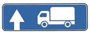
Shows the route recommended for goods vehicles, tractors and self-propelled machinery where one of the directions at the junction is closed to them. It stands at the start of the recommended route before the junction, or 100–150 m ahead of it. The 'straight ahead' version.
7.15.2 Recommended Route for Goods Vehicles
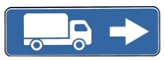
Shows the route recommended for goods vehicles, tractors and self-propelled machinery where one of the directions at the junction is closed to them. The 'to the right' version.
7.15.3 Direction of Movement for Trucks
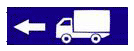
Shows the route recommended for goods vehicles, tractors and self-propelled machinery where one of the directions at the junction is closed to them. The signs stand at the start of the recommended route before the junction, or 100−150 metres ahead of it.
7.16 Stop Line

Marks where a vehicle stops at a controlled junction and at an uncontrolled railway crossing.
7.17 Detour Scheme
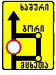
Shows the way round a stretch of road temporarily closed to traffic. Outside a built-up area the sign stands 150−300 metres from the junction where the diversion begins, and 50−100 metres within one.
7.18.1 Detour Direction (Straight)
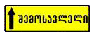
Shows the direction round a stretch of road temporarily closed to traffic. The signs stand on the diversion route before every junction.
7.18.2 Detour Direction (Right)
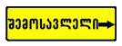
Shows the direction round a stretch of road temporarily closed to traffic. The signs stand on the diversion route before every junction.
7.18.3 Detour Direction (Left)
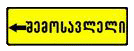
Shows the direction round a stretch of road temporarily closed to traffic. The signs stand on the diversion route before every junction.
7.19.1 Advance Indicator of Movement to Other Carriageway
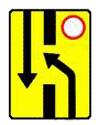
Shows the way round a closed section of carriageway on a road with a central reservation, or the way back onto the right-hand carriageway.
7.19.2 Advance Indicator of Movement to Other Carriageway
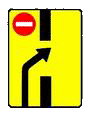
Shows the way round a closed section of carriageway on a road with a central reservation, or the way back onto the right-hand carriageway.
7.20.1 Electric Vehicle Charging Point
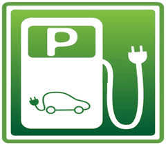
A place set aside for charging an electrically powered vehicle. Road markings define the zone in which the sign applies.
7.20.2 Parking for Vehicles Displaying the Disability Identification Sign

A place set aside for a vehicle displaying the 'Person with a Disability' identification sign. Road markings define the zone. The place may also be marked with sign 7.4 together with plate 8.17.
7.20.3 Parking for Tourist-Route Vehicles
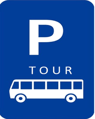
A place set aside for a vehicle operating a tourist route. Road markings define the zone.
7.20.4 Parking for Goods Deliveries
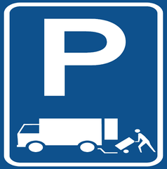
A place set aside for a vehicle delivering goods in connection with a business activity. Road markings define the zone.
7.20.5 Parking for Two-Wheeled Electric Scooters
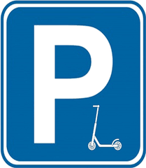
A place set aside for parking two-wheeled electric scooters. Road markings define the zone.
7.20.6 Parking for Motorcycles and Mopeds (Other than Three-Wheeled)
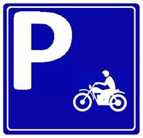
A place set aside for parking motorcycles and mopeds other than three-wheeled ones.
Note: Signs 7.6 and 7.7 stand at every entrance to, and passage of, the pedestrian crossing.
Note: On signs 7.9.1, 7.9.2, 7.10.1 and 7.10.2 placed outside a built-up area, a green or blue ground means the route to the place named runs by motorway or by another road respectively. On the same signs within a built-up area, a green or blue ground means that, once out of this settlement, the route runs by motorway or another road respectively, while a white ground means the place named is inside this settlement.
Supplementary Information Plates
8.1.1 Distance to Object
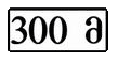
States the distance from the sign to the start of the hazard, to where the restriction begins, or to a particular place ahead in the direction of travel.
8.1.2 Distance to Object
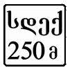
States the distance from sign 2.3 to the junction, where a 2.4 stands at the junction.
8.1.3 Distance to Object
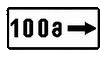
States the distance to something standing away from the road.
8.1.4 Distance to Object
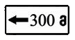
States the distance to something standing away from the road.
8.2.1 Zone of Effect
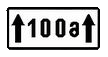
States the length of the hazard marked by a warning sign, or the zone of a prohibitory or information sign.
8.2.2 Zone of Effect
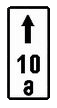
States the zone of signs 3.27–3.30.
8.2.3 Zone of Effect

Marks the end of the zone of signs 3.27–3.30.
8.2.4 Zone of Effect
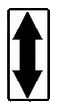
Tells the driver that they are inside the zone of signs 3.27–3.30.
8.2.5 Zone of Effect
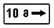
The zone of signs 3.27–3.30 where stopping and parking are barred along one side of a square, a building frontage and the like.
8.2.6 Zone of Effect
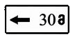
The zone of signs 3.27–3.30 where stopping and parking are barred along one side of a square, a building frontage and the like.
8.3.1 Direction of Effect
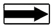
Shows the direction in which a sign placed before a junction applies, or the way to the marked place immediately beside the road.
8.3.2 Direction of Effect
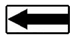
Shows the direction in which a sign placed before a junction applies, or the way to the marked place immediately beside the road.
8.3.3 Direction of Effect
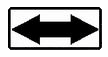
Shows the direction in which a sign placed before a junction applies, or the way to the marked place immediately beside the road.
8.4.1 Vehicle Type
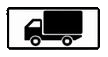
Names the class of vehicle the sign applies to.
8.4.2 Vehicle Type
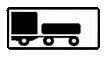
Names the class of vehicle the sign applies to.
8.4.3 Vehicle Type
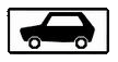
Names the class of vehicle the sign applies to.
8.4.4 Vehicle Type
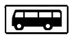
Names the class of vehicle the sign applies to.
8.4.5 Vehicle Type
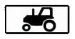
Names the class of vehicle the sign applies to.
8.4.6 Vehicle Type

Names the class of vehicle the sign applies to.
8.4.7 Vehicle Type

Names the class of vehicle the sign applies to.
8.4.8 Vehicle Type
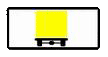
Names the class of vehicle the sign applies to.
8.5.1 Saturday, Sunday and Holidays
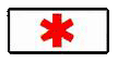
States the days of the week on which the signs apply.
8.5.2 Working Days
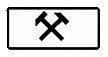
States the days of the week on which the signs apply.
8.5.3 Days of the Week
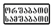
States the days of the week on which the signs apply.
8.5.4 Time of Effect
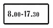
States the time of day at which the sign applies.
8.5.5 Time of Effect
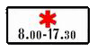
States the days of the week and the times of day at which the signs apply.
8.5.6 Time of Effect
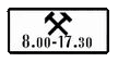
States the days of the week and the times of day at which the signs apply.
8.5.7 Time of Effect
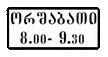
States the days of the week and the times of day at which the signs apply.
8.6.1 Vehicle Parking Method
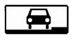
Sets out how a vehicle is to be parked: plate 8.6.1 means every vehicle stands on the carriageway alongside the pavement, while plates 8.6.2–8.6.9 show how cars and motorcycles are to stand in a bay beside the pavement.
8.6.2 Vehicle Parking Method
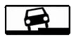
Sets out how a vehicle is to be parked: plate 8.6.1 means every vehicle stands on the carriageway alongside the pavement, while plates 8.6.2–8.6.9 show how cars and motorcycles are to stand in a bay beside the pavement.
8.6.3 Vehicle Parking Method

Sets out how a vehicle is to be parked: plate 8.6.1 means every vehicle stands on the carriageway alongside the pavement, while plates 8.6.2–8.6.9 show how cars and motorcycles are to stand in a bay beside the pavement.
8.6.4 Vehicle Parking Method
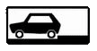
Sets out how a vehicle is to be parked: plate 8.6.1 means every vehicle stands on the carriageway alongside the pavement, while plates 8.6.2–8.6.9 show how cars and motorcycles are to stand in a bay beside the pavement.
8.6.5 Vehicle Parking Method
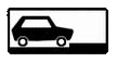
Sets out how a vehicle is to be parked: plate 8.6.1 means every vehicle stands on the carriageway alongside the pavement, while plates 8.6.2–8.6.9 show how cars and motorcycles are to stand in a bay beside the pavement.
8.6.6 Vehicle Parking Method
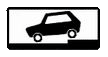
Sets out how a vehicle is to be parked: plate 8.6.1 means every vehicle stands on the carriageway alongside the pavement, while plates 8.6.2–8.6.9 show how cars and motorcycles are to stand in a bay beside the pavement.
8.6.7 Vehicle Parking Method
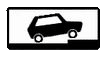
Sets out how a vehicle is to be parked: plate 8.6.1 means every vehicle stands on the carriageway alongside the pavement, while plates 8.6.2–8.6.9 show how cars and motorcycles are to stand in a bay beside the pavement.
8.6.8 Vehicle Parking Method
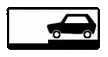
Sets out how a vehicle is to be parked: plate 8.6.1 means every vehicle stands on the carriageway alongside the pavement, while plates 8.6.2–8.6.9 show how cars and motorcycles are to stand in a bay beside the pavement.
8.6.9 Vehicle Parking Method
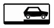
Sets out how a vehicle is to be parked: plate 8.6.1 means every vehicle stands on the carriageway alongside the pavement, while plates 8.6.2–8.6.9 show how cars and motorcycles are to stand in a bay beside the pavement.
8.7 Parking with Engine Off
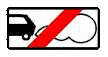
Shows that in the parking place marked by sign 7.4 a vehicle may stand only with its engine switched off.
8.8 Paid Service
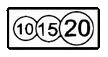
Shows that the parking place marked by sign 7.4 is charged for.
8.9 Parking Duration Limit
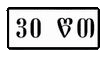
Shows that in the parking place marked by sign 7.4 the length of stay is limited.
8.10 Vehicle Inspection Place
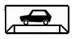
Shows that the area marked by sign 7.4 or 6.10 has a ramp or an inspection pit.
8.11 Maximum Permitted Mass Limit
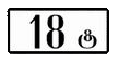
Shows that the sign applies only to a vehicle whose permitted maximum mass exceeds the figure on the plate.
8.12 Dangerous Roadside

Warns that moving onto the verge is dangerous because work is under way there. The plate is used with sign 1.26.
8.13 Direction of Main Road

Shows the course of the major road through a junction. The plate is used with signs 2.1, 2.3 and 2.4 where the major road changes direction there.
8.14 Lane

Names the lane to which the sign or signal applies. The plate is mounted above that lane.
8.15 Blind Pedestrian

Shows that the crossing is used by blind or partially sighted people. The plate is used with signs 1.23, 5.19.1 and 5.19.2 and with signals.
8.16 Wet Surface

Shows that the sign applies while the carriageway surface is wet. The plate is used with signs 1.16, 3.20, 3.22 and 3.24.
8.17 Person with a Disability
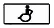
Shows that sign 7.4 applies to a vehicle displaying the 'Person with a Disability' identification sign. The place may also be marked with sign 7.20.2.
8.18 Except Persons with a Disability

Shows that the sign does not apply to a vehicle displaying the 'Person with a Disability' identification sign.
8.19 Class of Dangerous Goods
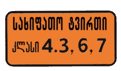
Shows that the sign applies to vehicles carrying goods of the danger class shown on the plate under state standard 19433-88. The plate is used with signs 3.32, 3.33 and 4.9.1–4.9.3.
8.20.1 Vehicle Bogie Type

Shows the number of closely spaced axles for each of which the mass given on sign 3.12 is the permitted limit. The two-axle version.
8.20.2 Vehicle Bogie Type

Shows the number of closely spaced axles for each of which the mass given on sign 3.12 is the permitted limit. The three-axle version.
8.21.1 Type of Route Service
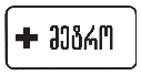
Indicates a park-and-ride space at a metro station. The plate is used with sign 7.4.
8.21.2 Type of Route Service
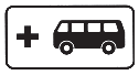
Indicates a park-and-ride space at a metro station with a connection to bus and/or trolleybus services. The plate is used with sign 7.4.
8.21.3 Type of Route Service
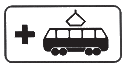
Indicates a park-and-ride space at a metro station with a connection to tram services. The plate is used with sign 7.4.
8.22.1 Obstruction

Used together with sign 4.2.1 to help the driver judge the way round an obstruction.
8.22.2 Obstruction

Used together with sign 4.2.2 to help the driver judge the way round an obstruction.
8.22.3 Obstruction

Used together with sign 4.2.3 to help the driver judge the way round an obstruction.
Note: The plates extend the sign to: (a) 8.4.1 — a goods vehicle, with or without a trailer, whose permitted maximum mass is above 3.5 t; (b) 8.4.2 — a goods vehicle or tractor with a trailer or semi-trailer of any kind, and a vehicle towing a motor vehicle; (c) 8.4.3 — a car; (d) 8.4.8 — a vehicle displaying the 'Dangerous Goods' identification sign.
Note: (a) supplementary plates go directly beneath the sign they belong to. Plates 8.2.2–8.2.4 and 8.13 go beside the sign where it is mounted above the carriageway, the shoulder or the pavement; (b) where temporary signs on a portable stand and permanent signs conflict, the driver follows the temporary ones; (c) supplementary plates other than those listed here may be used where they help drivers read the road.
Road Markings (Annex No. 2)
Road markings set out particular traffic regimes and rules, give the driver a visual reference, and may be used on their own or together with other traffic-control devices. Where temporary signs on a portable stand and the marked lines mean different things, the driver follows the signs.
Horizontal Markings
Horizontal markings — lines, arrows, legends and other marks on the carriageway — are white, except lines 1.4, 1.10 and 1.17, which are yellow, and marking 1.28, which is red.
1.1 Solid Line

Separates opposing traffic flows and, on a hazardous stretch, marks the edge of a lane or of the carriageway that must not be entered; it also marks the boundary of parking places and the edge of a carriageway that is not a motorway. Crossing line 1.1 is prohibited. It may be crossed where it marks the carriageway edge to the driver's right, in order to stop on the shoulder.
1.2.1 Wide Solid Line

A wide solid line marking the edge of the carriageway on a motorway. Crossing line 1.2.1 is prohibited. It may be crossed where it lies to the driver's right, in order to stop on the shoulder.
1.2.2 Wide Broken Line

A wide broken line marking the edge of the carriageway on an express road.
1.3 Double Solid Line
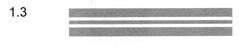
Separates opposing traffic flows on a road with four or more lanes. Crossing line 1.3 is prohibited.
1.4 Yellow Solid Line

A yellow solid line marking where stopping is prohibited; used on its own or together with sign 3.27, and laid at the carriageway edge or along the top of the kerb.
1.5 Broken Line

Separates opposing traffic flows on a road with two or three lanes, and marks lane boundaries where two or more lanes run in the same direction. Line 1.5 may be crossed from either side.
1.6 Approach Line

A broken line whose strokes are three times longer than the gaps, warning that marking 1.1 or 1.11 — which separates opposing or same-direction flows — is coming up. It is laid at least 50–100 m before that marking, and may be crossed from either side.
1.7 Short-Stroke Broken Line

A broken line with short strokes and equal gaps, marking a lane within a junction. It may be crossed from either side.
1.8 Wide Broken Line at Slip Lanes

A wide broken line marking the boundary between an acceleration or deceleration lane and the main carriageway — at a junction, a grade-separated crossing, a bus stop area and so on. It may be crossed from either side.
1.9 Reversible Lane Line

Marks the boundary of a reversible lane and, when the reversible signal is off, separates opposing flows on such a road. Line 1.9 may be crossed if it lies to the driver's right and there is no reversible signal or it is off. With the signal on it may be crossed from either side where it divides lanes running the same way. When the signal switches off the driver must move right of line 1.9 at once. Crossing it where it separates opposing flows with the signal off is prohibited.
1.10 Yellow Broken Line

A yellow broken line marking where parking is prohibited; used on its own or together with sign 3.28, and laid at the carriageway edge or along the top of the kerb.
1.11 Solid Line Beside a Broken One

Separates opposing or same-direction flows where changing lanes is allowed from one side only; it also marks a U-turn place, the entrance to and exit from a parking area and the like, where movement is allowed in one direction only. Line 1.11 may be crossed from the broken side, and from the solid side only when finishing an overtake or a manoeuvre round an obstruction.
1.12 Stop Line

Marks where the driver must stop when sign 2.4 is present, or on a prohibiting signal from the traffic light or the traffic controller.
1.13 Give-Way Line
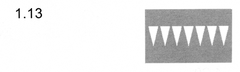
Marks where the driver must, if necessary, stop and give way to traffic on the road being crossed.
1.14.1 Pedestrian Crossing
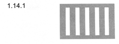
Marks an uncontrolled pedestrian crossing.
1.14.2 Zebra Crossing
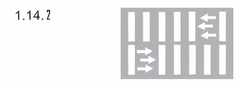
The zebra marks an uncontrolled pedestrian crossing. The arrow in the marking shows the direction pedestrians take.
1.15 Cycle Track Crossing
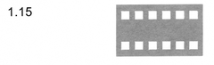
Marks where a cycle track crosses the carriageway.
1.16.1 Traffic Island — Diverging
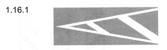
Marks a traffic island where opposing flows divide.
1.16.2 Traffic Island — Diverging
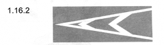
Marks a traffic island where opposing flows divide.
1.16.3 Traffic Island — Merging
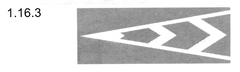
Marks a traffic island where opposing flows merge.
1.17 Yellow Stop-Bay Line
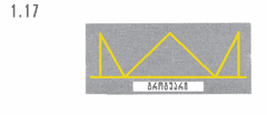
A yellow line marking a route-service vehicle stop and a taxi rank.
1.18 Lane Direction Arrows
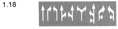
Shows the directions permitted from a lane at a junction; used on its own or together with signs 5.15.1 and 5.15.2. A marking that allows a left turn from the leftmost lane also allows a U-turn from it.
1.19 Narrowing Warning
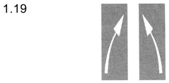
Warns of a narrowing carriageway, of a stretch where the number of lanes in this direction drops, or of an approach to marking 1.1 or 1.11 separating opposing flows. In the first case it may be used together with signs 1.21.1–1.21.3.
1.20 Give-Way Warning
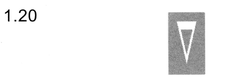
Warns that marking 1.13 is coming up.
1.21 'STOP' Legend
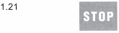
The word STOP painted on the road warns that marking 1.12 is coming up, where that marking is used together with sign 2.4.
1.22 Road (Route) Number
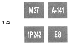
Shows the number of the road or route.
1.23 Route-Service Lane

Marks a lane reserved for route service vehicles. The marking that sets such a lane apart may be yellow.
1.24.1 Warning Sign Repeated on the Road
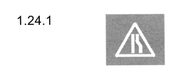
Repeats a warning sign on the road surface; it is laid 20–30 m from where that sign stands.
1.24.2 Prohibitory Sign Repeated on the Road
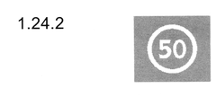
Repeats a prohibitory sign on the road surface; it is laid in the same cross-section of the road as that sign.
1.24.3 Disabled Parking Bay
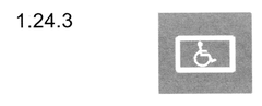
Marks a parking place reserved for a vehicle displaying the 'Person with a Disability' identification sign.
1.24.4 Electric Vehicle Charging Bay
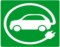
Marks a bay set aside for charging an electrically powered vehicle. The marking is laid on a green background or without one.
1.24.5 Tourist-Vehicle Parking Bay
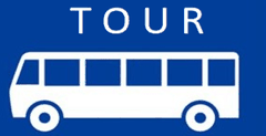
Marks a bay set aside for a vehicle operating a tourist route. The marking is laid on a blue background or without one.
1.24.6 Goods Delivery Bay
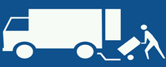
Marks a bay set aside for a vehicle delivering goods in connection with a business activity. The marking is laid on a blue background or without one.
1.24.7 Electric Scooter Bay
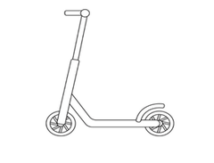
Marks a bay set aside for two-wheeled electric scooters.
1.25 Road Hump
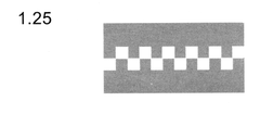
Marks an artificial hump built to force traffic to slow down.
Note: Horizontal markings 1.1–1.11 may be referred to as longitudinal markings, and markings 1.1, 1.3, 1.5, 1.6 and 1.11 as the centre line.
1.26 Motorcycles and Mopeds Allowed in the Route-Service Lane
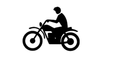
Shows that motorcycles and mopeds other than three-wheeled ones may use the lane reserved for route service vehicles. This marking may be used without sign 5.41.1.
1.27 Cycle Road Carriageway
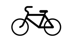
Marks the carriageway of a cycle road.
1.28 No Stopping at a Fire Hydrant
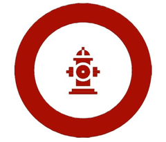
A red line encloses the place where stopping at a fire hydrant is prohibited, except in the case covered by note 'g.e' to point 3 of Annex No. 1 to the law (fire engines). The absence of marking 1.28 does not release the driver from the requirement of sign 3.34 'No Stopping at a Fire Hydrant'.
Note: The absence of marking 1.28 does not release the driver from the requirement of sign 3.34 ('No Stopping at a Fire Hydrant').
Vertical Markings
Vertical markings combine white and black stripes on bridge piers, tunnel portal faces, barriers, parapets, kerbs and other roadside furniture, to make them easier for road users to see.
2.1.1 Vertical Element on the Left

Marks a bridge pier, lighting column, tree, crash cushion and the like standing to the left of the carriageway and dangerous to passing traffic. An obstruction marked 2.1.1 is passed on the right.
2.1.2 Vertical Element on the Carriageway

Marks a bridge pier, lighting column, tree, crash cushion and the like standing on the carriageway itself and dangerous to passing traffic. An obstruction marked 2.1.2 may be passed on either side.
2.1.3 Vertical Element on the Right

Marks a bridge pier, lighting column, tree, crash cushion and the like standing to the right of the carriageway and dangerous to passing traffic. An obstruction marked 2.1.3 is passed on the left.
2.2 Low Structure Edge
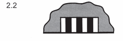
Marks the lower edge of a tunnel, bridge, overpass or other structure standing less than 5 m above the carriageway that passes wholly or partly beneath it.
2.3 Round Bollard
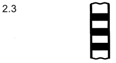
Marks a round bollard set on a central reservation, a raised traffic island or a refuge island.
2.4 Guide Post
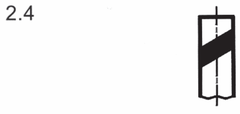
Marks a guide post, bollard, barrier support and the like.
2.5 Barrier Face — Hazardous Section

Marks the side face of a safety barrier on a straight stretch, at a grade-separated crossing, on a curve of less than 50 m radius, on a steep descent and where the carriageway narrows.
2.6 Barrier Face — Other Sections

Marks the side face of a safety barrier on stretches other than those covered by marking 2.5.
2.7 Island and Kerb Face

Marks the side face of a raised traffic island, refuge island, kerb or obstruction standing within one metre of the carriageway — on a small-radius curve, on an embankment, where the road narrows and at the exit from another hazardous stretch.
Vehicle Identification Signs (Annex No. 3)
Identification signs are fixed to a vehicle to mark it out where its dimensions, its driver, its passengers or the kind of load it carries differ from the standard case.
'Road Train'
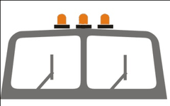
Three orange lamps set horizontally above the cab, 150 to 300 mm apart. Fitted to a road train and to an articulated bus.
'Studded Tyres'
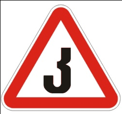
A white equilateral triangle pointing upwards with a red border and the black letter კ inside (side at least 200 mm, border one tenth of the side). Fitted to the rear of a vehicle running on studded tyres.
'Children on Board'
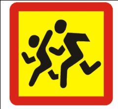
A yellow square with a red border (side at least 250 mm, border one tenth of the side) carrying the symbol of sign 1.24 in black. Fitted to the front and rear of a bus carrying groups of children.
'Hearing-Impaired Driver'

A yellow disc 160 mm across with three black circles 40 mm across set at the corners of an imaginary equilateral triangle pointing downwards. Fitted to the front and rear of a motor vehicle driven by a hearing-impaired driver as defined by joint ministerial order.
'Dangerous Goods'
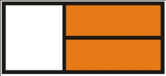
A rectangular orange plate 400×300 mm with a 15 mm black border — on the front and rear of a vehicle carrying such goods, and on the sides as well in the case of a tanker. The UN number of the load goes in the lower half and the hazard identification number in the upper half, separated by a 15 mm black horizontal line across the middle.
'Learner Vehicle'
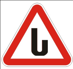
A white isosceles triangle pointing upwards with a red border and the black letter ს inside (side at least 200 mm, border one tenth of the side). Fitted to the front and rear of a learner vehicle; on a car a double-sided sign may be mounted on the roof.
'Speed Limit'
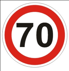
A reduced colour image of sign 3.24 showing the permitted speed (at least 160 mm across, border one tenth of the diameter). Fitted at the rear left of the body of an oversize vehicle or a vehicle carrying dangerous goods driven by someone with less than two years' experience, and also where the vehicle's technical maximum speed is below the figure set by Article 33 §7 of the law.
'Oversize Load'
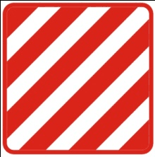
A 400×400 mm board with alternating red and white diagonal stripes 50 mm wide in retroreflective material. Fitted to the front and rear of oversize vehicles and of the vehicles covered by Article 47 §13 of the law.
'Long Vehicle'

A yellow rectangle at least 1200×200 mm with a 40 mm red border in retroreflective material. Fitted to the rear of an oversize vehicle more than 20 m long laden or unladen, and to a combination with two or more trailers. Where a sign of that size cannot be fitted, two identical signs of at least 600×200 mm may be mounted symmetrically about the vehicle's axis.
'Person with a Disability'
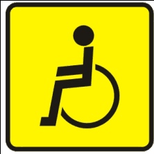
A yellow square 150 mm on a side carrying the symbol of sign 8.17 in black. It may be fitted to the front and rear of a motor vehicle driven by, or carrying, a person with a significant or pronounced disability status — except where the municipality has established its own identification sign and the list of people entitled to it.
'Doctor'

A blue square 140 mm on a side with a white disc 125 mm across bearing a red cross (90 mm high, 25 mm stroke). It may be fitted to a vehicle driven by a doctor.
'Warning Triangle'
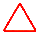
A board in the shape of an equilateral triangle with sides of at least 0.4 m and a red border at least 0.05 m wide. The centre may be open or painted a light colour. The red border must be opaque or carry a retroreflective strip. The board must stand steadily upright.
'Distinguishing Sign of the State of Registration'
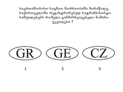
The distinguishing sign of a Georgian-registered vehicle in international traffic. It is an ellipse with axes of at least 0.175×0.115 m carrying Georgia's international code GE. The Latin letters are at least 0.08 m high with strokes at least 0.01 m wide, in black on a white ground, which may be retroreflective. It must be fitted so that it cannot be taken for the registration plate and does not make the plate harder to read.
Types of Traffic Light (Annex No. 4)
Traffic lights are used to control the movement of vehicles and pedestrians, and to mark a hazardous stretch of road.
The coloured aspects of a traffic light mean: (a) a red aspect, steady or flashing, prohibits movement; (b) red and amber lit together prohibit movement and announce that green is about to appear; (c) an amber aspect prohibits movement, except in the cases covered by Article 29 §14 of the law, and announces that the aspect is about to change; (d) a flashing amber aspect permits movement and announces an uncontrolled junction, a pedestrian or cycle crossing, or a possible hazard; (e) a green aspect permits movement; (f) a flashing green aspect permits movement and tells road users that its time is running out and a prohibiting aspect will follow shortly.
The following signals are used to control vehicle movement:
T.1
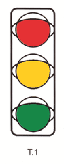
The standard three-aspect vertical vehicle signal: red at the top, amber in the middle, green at the bottom.
T.1 right
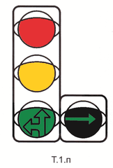
The three-aspect signal with an extra section to the right at green level — a green aspect showing an arrow.
T.1 left
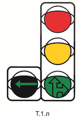
The three-aspect signal with an extra section to the left at green level.
T.1 right and left
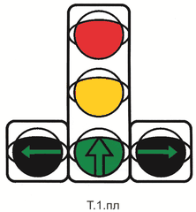
The three-aspect signal with two extra sections, one to each side at green level.
T.1 horizontal
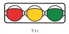
The three-aspect signal laid out horizontally: red on the right, amber in the middle, green on the left.
T.2
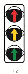
A three-aspect signal whose lenses carry arrows: it governs only the direction the arrow points.
T.3
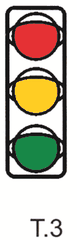
A two-aspect signal used at a railway crossing, a fire-station exit and similar places.
T.3 right
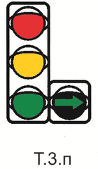
The two-aspect signal with an extra section to the right.
T.3 left
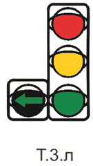
The two-aspect signal with an extra section to the left.
T.4
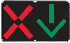
The reversible-lane signal: a red X bars the lane, a downward green arrow opens it. It governs only the lane it hangs above.
T.4 amber
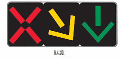
The reversible-lane signal with an extra amber or white diagonal arrow, which warns that the aspect is about to change and requires a move into the lane the arrow points to.
T.5
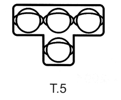
Four amber aspects in a T layout, governing a route-service lane. Movement is allowed only when the lower aspect and one or more upper aspects are lit together: the left one permits a left turn, the middle one straight ahead, the right one a right turn. If only the three upper aspects are lit, movement is prohibited.
T.6
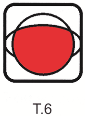
A single red aspect, used where movement is barred from time to time.
T.6 extra
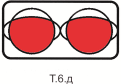
Two alternately flashing red aspects, used at railway crossings and similar places; they prohibit movement.
T.7
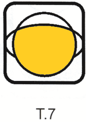
A single flashing amber aspect: movement is allowed, but an uncontrolled junction, a crossing or a possible hazard lies ahead.
T.8
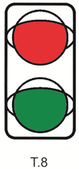
A two-aspect signal with red and green only, used where an amber aspect is not needed.
T.9
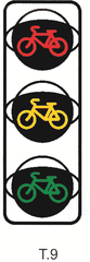
A cycle signal: its aspects carry the outline of a bicycle or cyclist, and it governs movement on a cycle track or cycle lane.
T.10
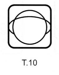
A single flashing white aspect, used to govern trams and other route service vehicles.
The following signals are used to control pedestrian movement:
P.1
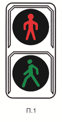
The pedestrian signal: red above, green below. It applies to pedestrians and to riders of two-wheeled electric scooters. Where a crossing has no such signal they follow the vehicle signal and cross only when vehicles are barred.
P.2
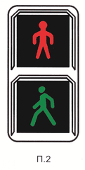
The second type of pedestrian signal, showing a walking figure. It may carry an audible signal for blind pedestrians: an intermittent tone means do not cross, a continuous tone means cross.